10 Reasons Why Your Business Needs A GIS Consultant

GIS technology is the next big thing your business needs. Microsoft, Apple, Intel and Dell are among the leading companies in the Fortune 500 list which are investing in Geographic Information Systems (GIS). Follow their lead and think beyond increasing the operational efficiency of your organization. It is time to bring in greater ROI that will surpass the cost of investment in leaps and bounds. Once you let GIS take the lead, there will be no looking back for your business. Soon you will be thinking graphically, making better decisions and saving more.
If you are intrigued by the benefits that GIS has in store for you, then this blog is a must-read for you. We have compiled all the benefits of investing in GIS services and also suggested the points you should keep in mind before hiring a GIS consultant. Keep scrolling below, you can thank us later.
- What is GIS?
- Application of GIS in Business & Everyday Life
- 10 reasons why you must hire a GIS Consulting Company
- How to evaluate & select a good GIS Consultant
- Final Thoughts
What is GIS?
Geographic Information Systems or GIS is a powerful decision-making tool that stores, checks and analyzes environmental, topographic and demographic data based on the Earth’s position. GIS applications collate information and exhibit different kinds of data intelligence on maps, thereby assisting companies to arrive at informed decisions and enjoy greater competitive advantage.
GIS mapping enables geo-visualization, a technique used to create a display of charts, maps, images and 3D views. It enables organizations to visualize data in a clear and concise manner. Advanced GIS systems portray multiple maps in a series of layers to show datasets that are accompanied with flawless data intelligence. Advanced GIS systems portray multiple maps in a series of layers to show datasets that are accompanied with flawless data intelligence.
Leading global organizations use the data intelligence compiled from the spatial and statistical methods of GIS technology for error-free record-keeping and seamless internal communication. The technology assists businesses to have a better understanding of recent trends, identify hidden pain-points, measure job growth in a given industry and predict the implications of future plans.
Application of GIS in Business & Everyday Life
The beauty of GIS is that it has something for everyone. Over the years, GIS technology has gone far beyond its set of primary capabilities. Presently, GIS systems leverage the utilities of big data, cloud computing, wearables and drones. Here are some wide scale applications of GIS technology that impacts our daily lives:
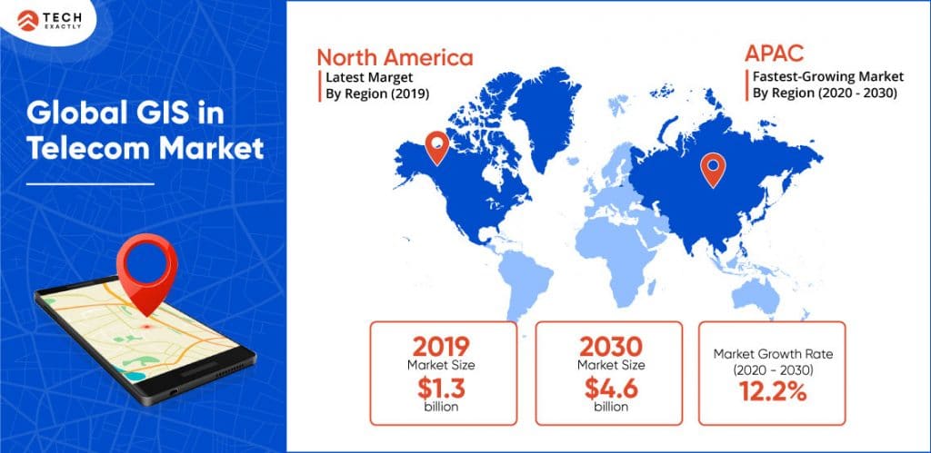
1. Telecom and Network Services:
GIS technology is largely being implemented by organizations to incorporate geographic data into their complex network design, planning and optimization. Telecommunications companies invest in scalable geospatial technology and data for benefits such as better location services, improved decision making, business process automation and other value-added services.
2. Transportation Services:
GIS services are globally implemented in the transportation sector because it helps in managing issues related to accident analysis, highway maintenance, traffic modelling and route planning. The recent integration of topical and environmental data into a GIS platform is enabling companies to plan new rail routes or road routes.
3. Urban Planning:
GIS has wide scale application in urban planning. With features such as spatial analysis and modeling, GIS contributes to multiple urban planning tasks such as land suitability analysis, land use, site selection, impact assessments and transport modeling. The technology not only charts the direction of expansion, but also conducts an analysis of the urban sector to identify new locations and secure the same for further development.
4. Energy & Utilities:
GIS consulting services assist organizations that function in the energy and utility sector by successfully integrating mapping data with geophysical and geological seismic interpretation. Thanks to advanced GIS mapping techniques, organizations can gain relevant insights related to exploration of specific geographic locations for oil, coal and gas.
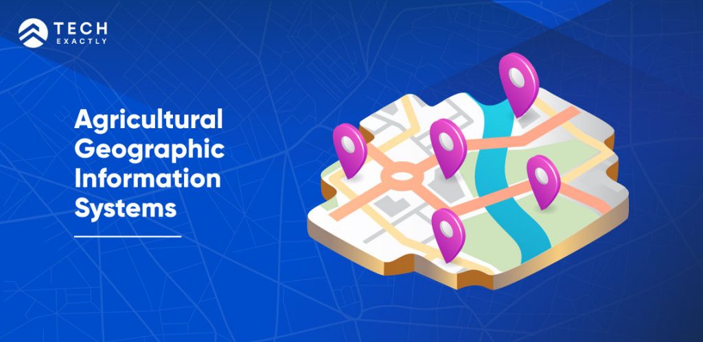
5. Agricultural Applications:
Agricultural Geographic Information Systems is reshaping the agriculture sector by helping farmers to increase production and simultaneously bring down costs with improved management of resources and land. Thanks to its advanced incorporation with using Geomatics Technology, now farmers can map efficient farming techniques, arrive at accurate estimations related to temperature, precipitation, etc.
6. GIS and Government:
GIS technology identifies the patterns of population change over a given space and time, thus assisting governments of multiple nations in collecting location-specific data. 2D and 3D GIS maps paired with spatial analysis reveal important patterns in demographic changes. The acquired GIS data can be saved, shared and analyzed in a collaborative learning environment to secure and improve the quality of life of citizens.
7. Banking:
GIS technology helps banks to create customer-centric business models. Thanks to data intelligence, now banks can adopt market-driven techniques to improve the quality of services and satisfy existing customer base. Chief benefits of the application of GIS in banking include expansion of customer base, improved management of databases, more profitability and successful identification of locations for growth of business.
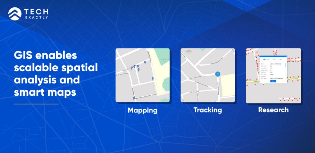
8. Healthcare Sector:
GIS enables scalable spatial analysis and smart maps, owing to which companies in the healthcare sector can optimize their mix of services and easily locate the best health facilities available in an area. Government agencies are using GIS to identify, monitor and prevent the spread of disease in a population.
9. Geology:
GIS technology uses sophisticated mapping software, thereby enabling users to display data related to one project. Displaying the data provides healthcare professionals with the ability to identify health related trends and target healing efforts based on the displayed results. Presently, GIS is being used to create health communications programs and analyze chronic disease trends such as diabetes, heart disease, etc.
10. Real Estate Sector:
GIS technology enables real estate professionals an edge to serve clients in a better way. By incorporating data from multiple databases and land maps, GIS facilitates relevant understanding of the market and its underlying associated factors. Successful application of GIS technology leads to better evaluation of sites, optimize tenant management and improve the effectiveness of marketing plans.
10 reasons why you must hire a GIS Consulting Company
Whether you are on the lookout for a solution to a complicated geographical problem or want to learn about recent trends in the market, a GIS consultant can help. A specialist on GIS excels in mapping and analyzing datasets based on specific location, thereby enabling you to visualize current data in a clear and concise manner. They study and break down the data sets, help design databases, support people that use GIS and integrate GIS with other technology. Beyond that, they also create well-written reports on their findings.
A good GIS consulting company assists your business with accurate analysis of data that brings in continual improvements in terms of productivity and profits. By enabling visualisation of your organisation’s data in an interactive manner, GIS drives in effective commercial decisions. Given below are ten top ways in which a GIS consultant will help your business stay ahead of the game:
1. Facilitates Seamless Internal Communication:
To attain higher operational efficiency in your business, it is advised to invest in a GIS services company. Such companies will help your employees get a thorough understanding of visual data,thereby promoting communication between multiple teams and departments. Advanced GIS technology increases participation in open discussions, thereby boosting overall operational efficiency of your businesses.
2. Predicts and Analyzes Current Trends:
Modern GIS technology identifies current trends, analyzes the acquired data and creates visual displays of its impact on the future of your business. GIS systems create multiple maps in layers to display one dataset along with relevant information. The learning from the data will not only enable you to measure job growth in your industry but also bring in competitive advantage. And who better to do all this for you, than a GIS consultant.
3. Flawless Multi-criteria Decision Making:
GIS consulting services exceed categorization of paradigms with arithmetic precision. It redefines multi-criteria decision making by analyzing complex issues. Modern GIS technology collaborates information from multiple sources to enable accurate analysis of data and reduce chances of faulty business decisions.
4. Simplifies Record-Keeping:
Thanks to a wide range of digital data management options, GIS service is the best match to the nature and complexity of your business. Using statistical software, a GIS expert will simplify the complexity of record-keeping and swiftly perform robust analysis by utilizing spatial data layers and multiple datasets.
5. Promotes Better Allocation of Resources:
GIS technology makes data integration straightforward and faster. The ability to view data on a map enables you to analyse it from a new perspective and gain fresh insights, thus helping to improve the accuracy of planning, thereby leading to better allocation of available resources.
6. Promotes Efficient Planning:
GIS data integrate geographic intelligence into the planning process. This increases situational awareness by making a wide range of real-time data available to businesses. Insights derived from current data not only assist in effective planning but also promote better allocation of resources. It increases overall efficiency and cuts down unnecessary costs that are a direct result of bad business decisions.
7. Helps Boost your Savings:
Thanks to flawless mapping of geo-spatial data, you can make proactive business decisions based on intelligent data that goes beyond boosting the efficiency of the business. A specialist will help you cut down on the operational costs and reduce unnecessary expenses.
8. Real-time Accident Analysis and Hot Spot Analysis:
Top GIS consulting firms incorporate accurate geographic data into a complex design of planning, optimization and maintenance activities. The optimized data intelligence not only pin points road networks that require maintenance, but also helps in identifying accident locations. The data acquired from GIS promotes better traffic management and significantly improves road safety measures.
9. Highlights Hidden Pain Points:
GIS services display geographic patterns in well-mapped data and successfully identify pain points that can be easily missed in a spreadsheet.
10. Conducts Accurate Global Forecasting:
GIS data compiles multiple features of the atmosphere to enable accurate global forecasting. Leading GIS services companies conduct predictive analysis based on a diverse range of forecasting tools and apply the learning to discover new sites for development, analyze climatological charts, monitor traffic and review topographical data. You can share the data via the web or your mobile and keep every employee of your organization on the same page.
How to evaluate & select a good GIS Consultant
If you want to make the most of this advanced technology, it is in your best interest to hire a professional from top GIS consulting companies without delay. Listed below are some characteristic of good GIS consultants:
- Possess strong IT skills. Many are proficient in programming languages such as R or Python. Some might also know front-end design languages (such as HTML, CSS) and a variety of mapping languages.
- Have an analytical mindset
- Are highly detail-oriented
- Are clean writers and thoughtful communicators
- Can manipulate complex databases
- Possess problem-solving skills
- Are systematic & methodical in storing records.
- Have experience with mapping tools such as vector and raster data, and spatial modeling.
- Understand the difference between GIS & CAD (computer-aided design). CAD is an automated design tool that lacks much of the “intelligence” of GIS and cannot perform analysis of information.
Here are some points that you should keep in mind while hiring a geospatial consultant for yourself:
- Consultant’s educational background & work experience – Do not shy away from asking for the total number of GIS projects completed by the consultant. They must be willing to answer your questions about previous work & clients. A good consultant should be able to explain about GIS in non-technical terms. If possible, make a visit and discuss the previous client’s experience and satisfaction with the products and services the consultant provided.
- Experience with GIS softwares – A GIS consultant should have significant training and hands-on experience using GIS softwares, not just experience in engineering or mapping. The consultant should be able to evaluate your data requirements and recommend products that will match your unique needs.
- Does the organisation own a GIS Software? If yes, what are the packages that best meet the needs of your business? How long has the organization used the software it owns?
- The total number of GIS database designs completed by the GIS consultant. Ask for the names of clients and descriptions of projects.
- Has the consultant worked on government projects before? See copies of plans developed by him/her for clients in the past.
- The consultant should be adequately staffed with knowledgeable programmers & analysts to understand collected data, or suggest useful applications, or to integrate GIS into existing information systems.
- Estimate for your project- Whether a freelancer or an organisation, he/she should (1) be able to provide a ballpark cost and time estimate for your project, (2) explain the long-term return on investment and (3) be upfront about additional costs. And most importantly, must be willing to make a quantifiable guarantee about the results of his/her proposal.
Final Thoughts
Despite a slow start to the year, GIS technology is proving to be increasingly instrumental in reshaping data analysis and mapping by exploiting the capacity of the cloud. It not only allows you to visualize data in a clear and concise manner, but also delivers rich analytics and mapping services that bring down operational costs and facilitates better planning and networking.
Modern GIS services are incorporated with AI to redefine interaction with big data, also known as Spatial Big Data (SBD). Geo-AI is still a relatively new field that aims to fuse machine learning and deep learning and apply the insights for work optimization and cost-efficiency.
Hire one of the top GIS consulting firms for your business
GIS technology is evolving with every passing day. If you want to stay on the forefront of business innovation and take your company to new heights, TechExactly will help you realize your dreams. From spatial mapping to custom 3D GIS mapping, remote-sensing to GIS application development, the experts at TechExactly bring in relevant insights by capturing geospatial information that reduces the cost of operation, promotes instant decision making and improves risk management.
We excel in GIS-based software development, which helps us to provide a diverse range of location-specific services and develop custom GIS mapping solutions for sectors like retail, construction, transportation, logistics, telecommunication, real estate, etc. Talk to an expert at TechExactly right away to take your business to new heights.